What is a “fast cycling route”?
A fast cycling route by definition of Michael W J Sørensen in “Sykkelekspressveger i Norge og andre land” is a “high standard bicycle path reserved for cyclists for fast and direct commuting over long distances”.
Initial Ontology
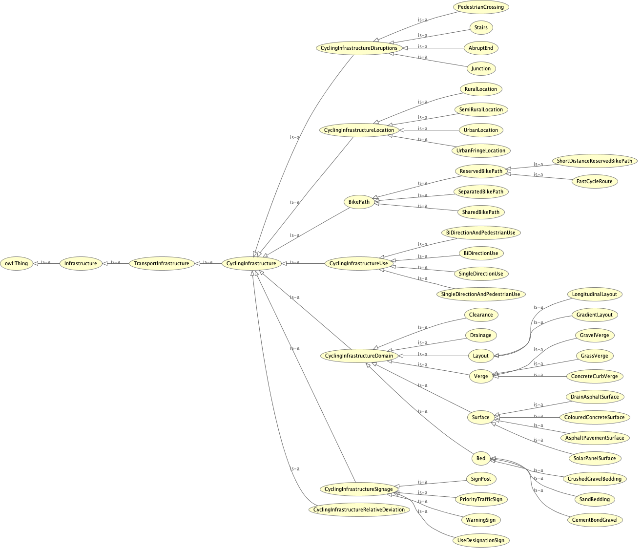
The initial ontology pretty much focused on this one special kind of cycling infrastructure. It appeared to be one subsystem of the cycling infrastructure ontology and of the bike path in particular. As there are lots of good examples in some and only a few projects like that in other countries, the use was seen in evaluating upcoming projects of that kind and finally just to better understand cyclists needs.
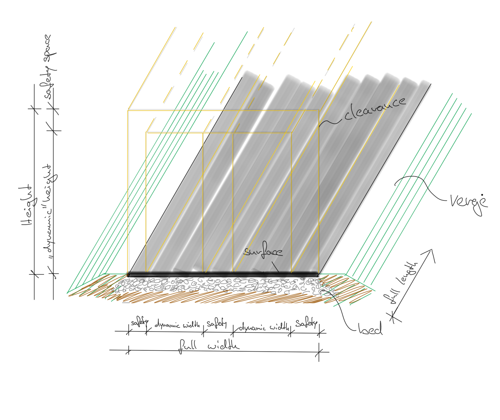
Parametrisation
The following hand sketch shows how some essential measurements have been parametrised. As it can be seen, the sketch is limited to physical parameters. Like their name, abstract parameters are abstract and thereby not visualisable easily. For those abstract criteria there was made an attempt to subdivide them into physical parameters of high influence on the resulting abstract level. Examples for that are the quality indicators: 1. Safety, 2. Coherence, 3. Directness, 4. Comfort, 5. Attractiveness. None of them can be measured objectively by physical variables.
Click here to download the .owl file.
Parametric 3d Model
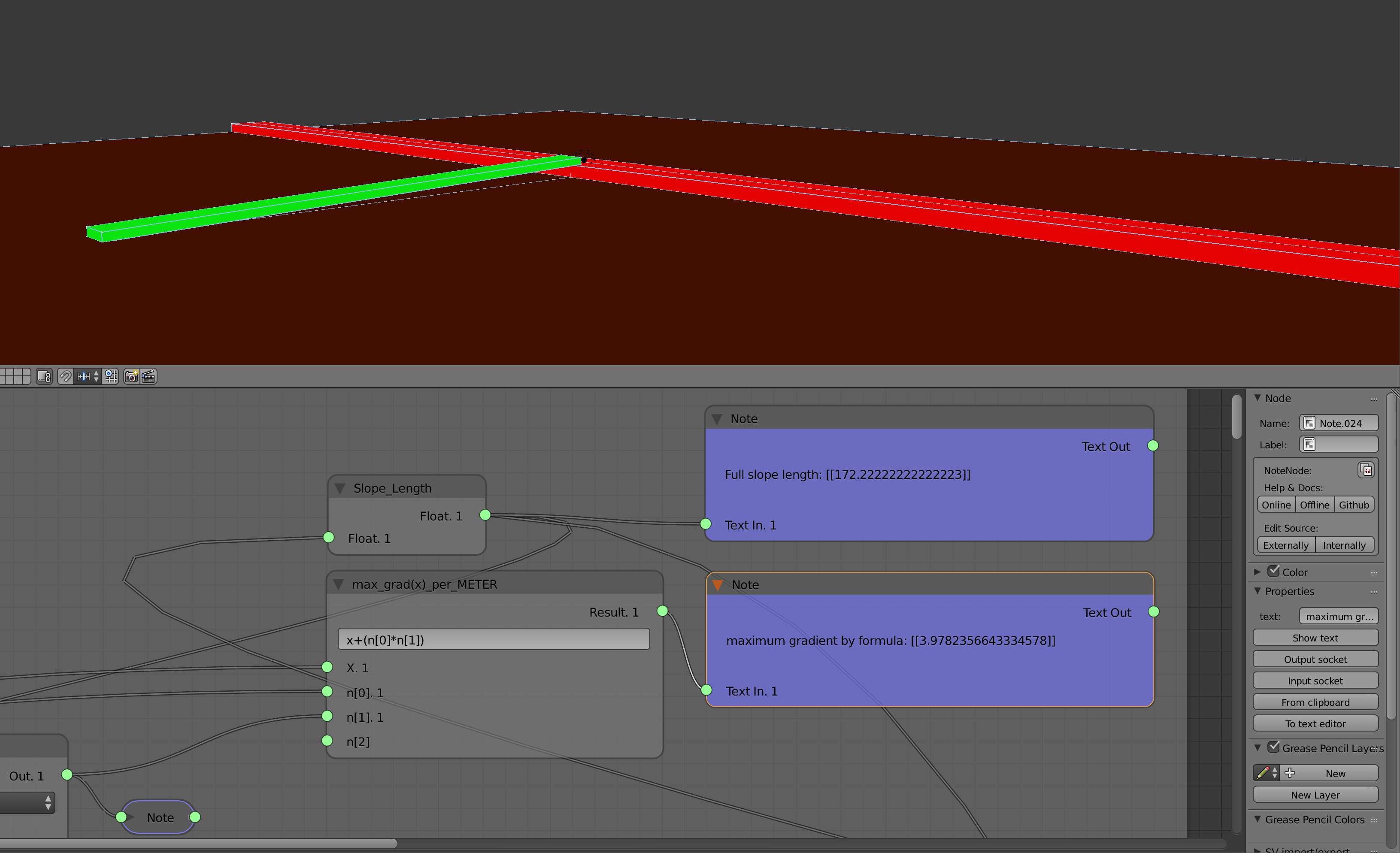
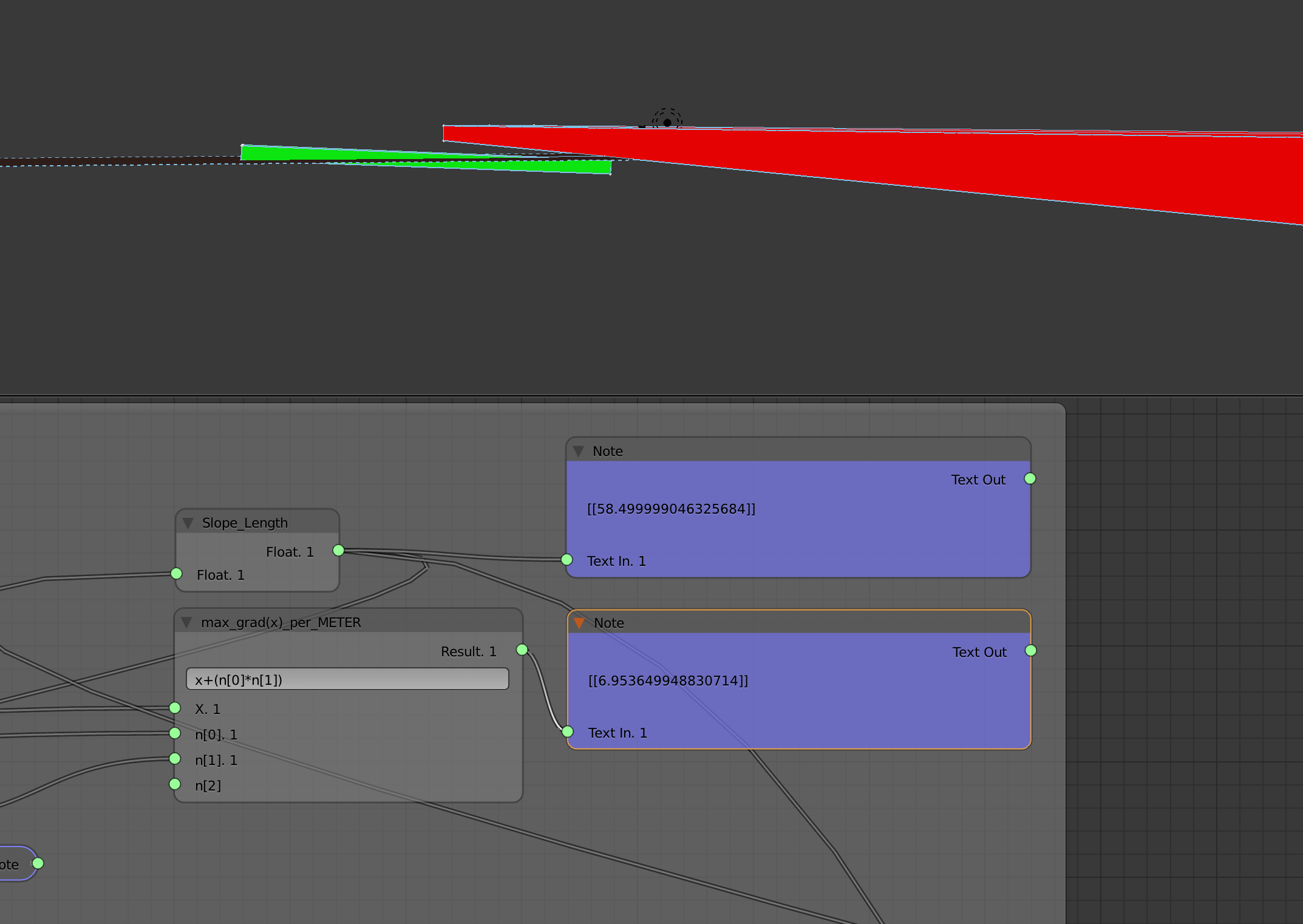
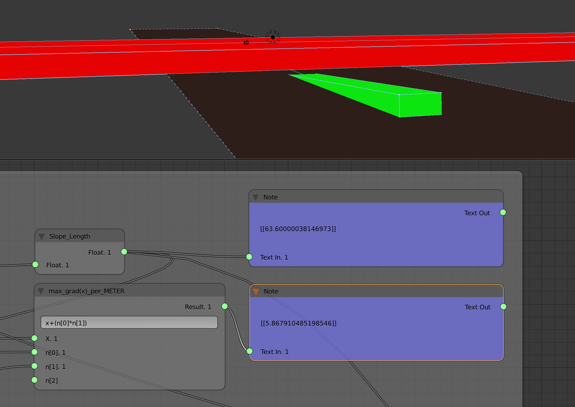
In rural areas the main challenge might be intersections with other participants in traffic (especially streets and railway-lines) and streams or rivers. For disrupting the bik- ers as little as possible and let them keep up their momentum overflies or underpasses are needed. To build those, a ramp is needed for the bike route to connect to an over- fly-bridge or an underpass. The clearance of the lower system has to be kept clear for both options. At the same time, the ramp’s gradient and it’s length has to fit the local design criteria. This is crucial to comfort and at the same time to attractiveness. Imagine you’d have to climb up a huge, steep, never ending incline every morning. That would definitely lower attractiveness of the every-day bike commute.
Modelling Logic
To model the visualisation of the challenge, geometry was reduced to the overall clearance of the cycle route and the clearance to cross as cube-structures. In addition a simple plane was created to represent the ground-level. One more simplification was made by only displaying half the system, more precisely only one slope.
To simply distinguish the different components they were given colours: red colour for the clearance that is to cross, brown colour for the ground-level and green colour for the fast cycle route.
The implemented 3d model was already chosen as it is regarding the surrounding systems modelled in the class. As a general cycling infrastructure model already exists it seemed useless to model a second one of just a subclass. That’s why the slope – as one major issue regarding attractiveness – was considered useful to later-on connect systems like cycling infrastructure, Bridge and/or Tunnel.
The Logic behind the model basically relies on an exponential function combining the five variable input parameters that can be found in almost every design handbook. The result is an exponential interpolated relation linking a slope’s length to its gradient. By defining in the beginning a maximum length for a specific gradient the function fits that to all gradients and/or lengthen in between.
Examples can be found on the following pictures.