The goal of this project was to create a parametric model of an upgrade of the Tiergarten S-Bahn station to meet the design needs: a water reclamation plant, highway underneath for easier connections, and a redesign of the bridge to bear a higher load due to increased freight traffic on the rail lines. With an additional focus on sustainability and accessibility for all passengers, the parametric model serves engineers and urban planners involved in the early stages of the planning of this station redesign.
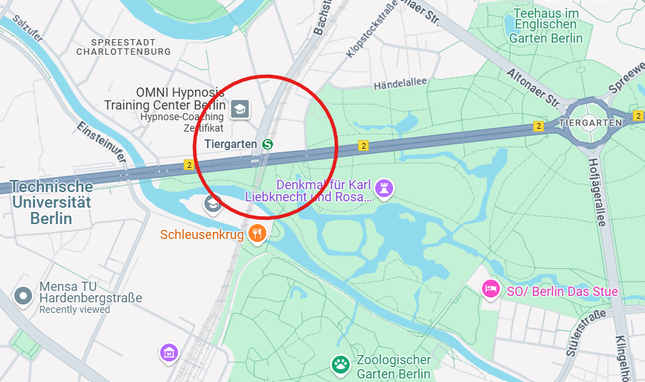
Figure 1: Location of the S-Tiergarten station in relation to TU Berlin (Google Maps)
The metro station serves as the connection point for all subsystems, in that employee facilities and a bakery/restaurant produce wastewater which passes through the sedimentation tank to the sludge digester for further processing. The metro station connects to the railway bridge which allows the trains to travel to and from S-Zoologischer Garten, the adjacent S-Bahn station (or in the case of freight traffic, bypass the stations entirely). The railway bridge is necessary due to the highway passing underneath, called Straße des 17. Juli / Bundesstraße 2. The highway already exists as an important connecting road between Mitte Berlin and Charlottenburg as well as the city outskirts for commuters and deliveries via truck.
Each of these subsystems is linked by its close proximity to the others, interfacing with pedestrians, cyclists, automobile and truck traffic, and trains. To be able to serve the professionals selecting design alternatives in the early planning stages, each model has at least three design parameters allowing the geometry to be modified to better fit the existing design constraints within the urban context.
The scope of the model does not extend beyond these five subsystems, or the original property currently used for the S-Bahn station. Additional relevant systems, for example piping and wastewater collection, will require more focus in the subsequent planning stages, however, for the purposes of this model, they were not included since they are expected to contribute insignificantly to the overall project’s cost and not depend significantly on the design variation chosen.
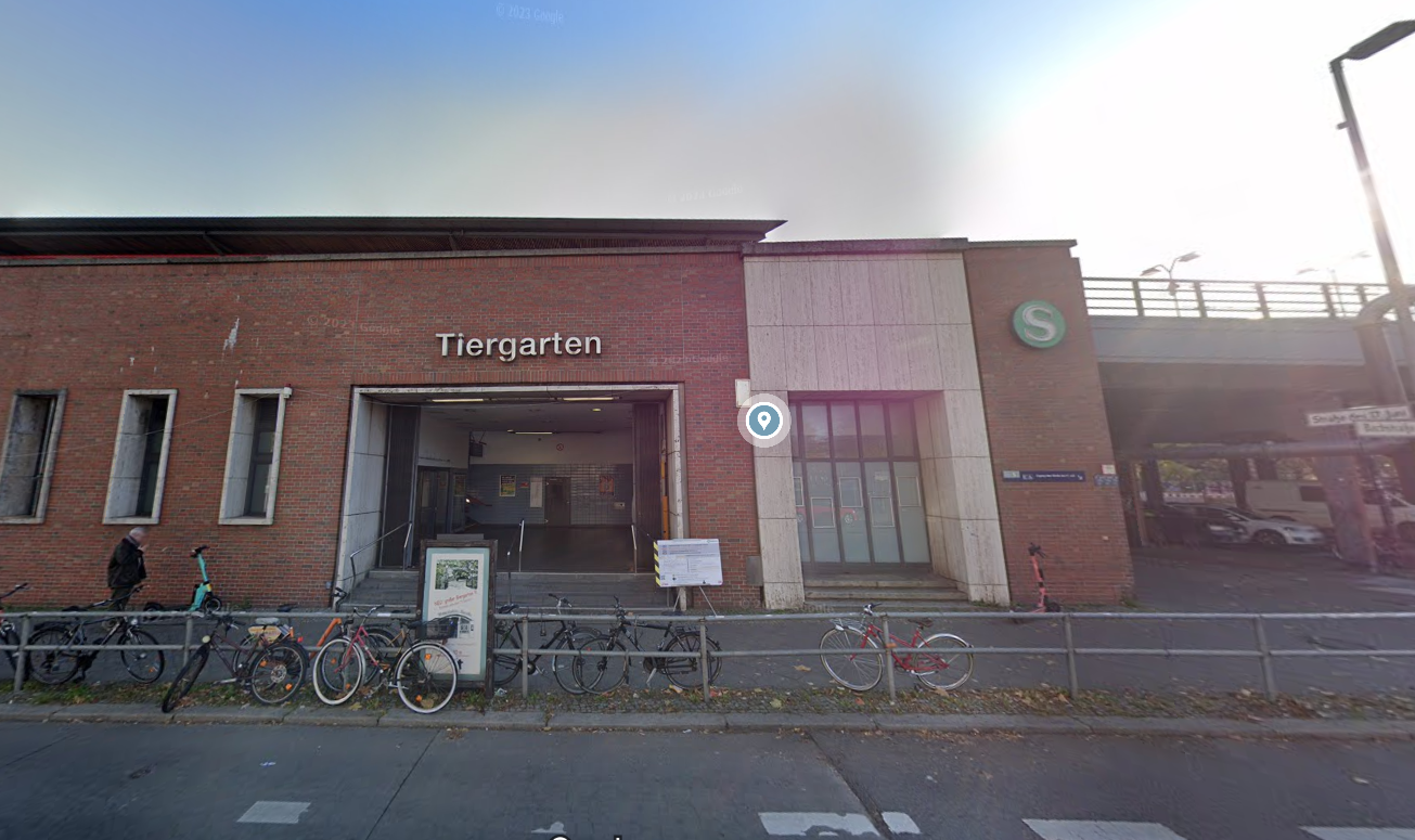
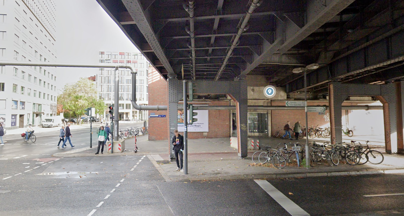
Figures 2 and 3 below show street-level views of the S-Bahn station to help better understand the urban context of the station.
 Figure 2: West entrance of S-Tiergarten Station (Google Maps)
 Figure 3: South entrance of S-Tiergarten station, view from the pedestrian crosswalk on Str. des 17. Juni (Google Maps)
